Pages

Saturday, December 21, 2013

Alone In the Desert Today

9/24/13
PCT mile 59.5-76.5   18 miles
Sunrise Trailhead to Scissor Crossing

Today I have a long day with 2 possible places for Robin to meet me.  Looking at my maps I don't think either road is passable but Robin wants to check it out for himself and we'll be in touch by iPhone. 
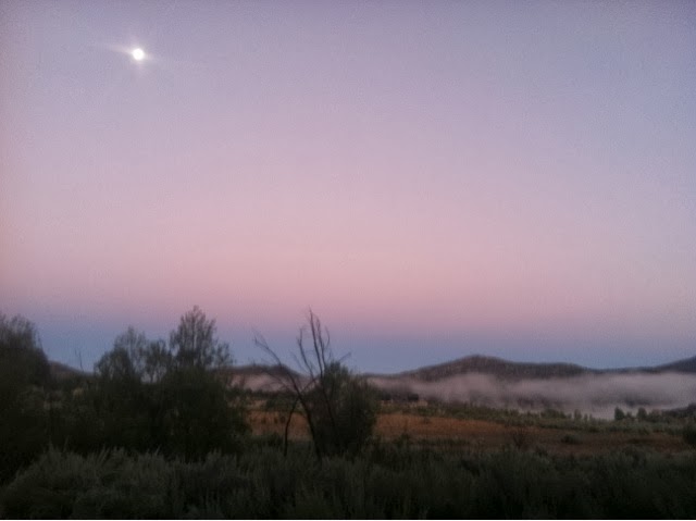
 We were up at 5:15 to see the sunrise and he dropped me off at the trailhead at 6:25.  It is cool, clear and slightly warmer than yesterday. 

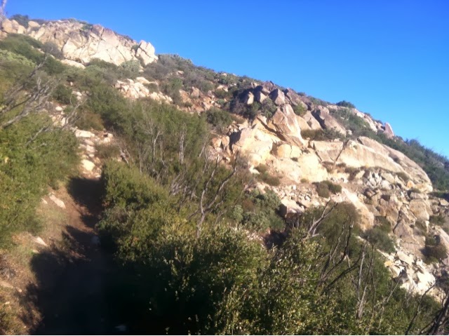
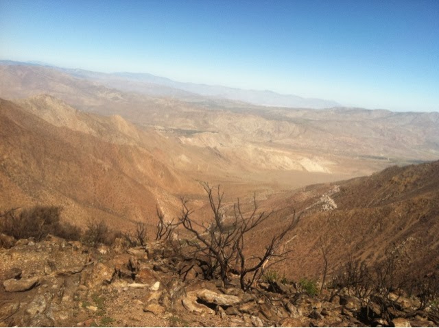
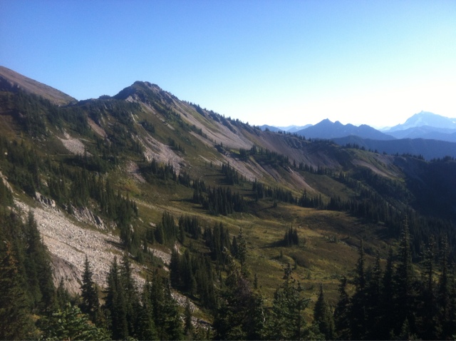
The trail winds through hills of chaparral 
and also follows a portion of the California Riding & Hiking Trail.  
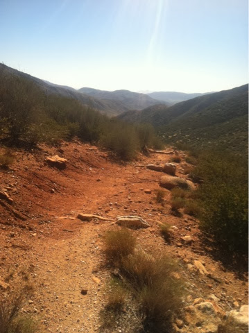
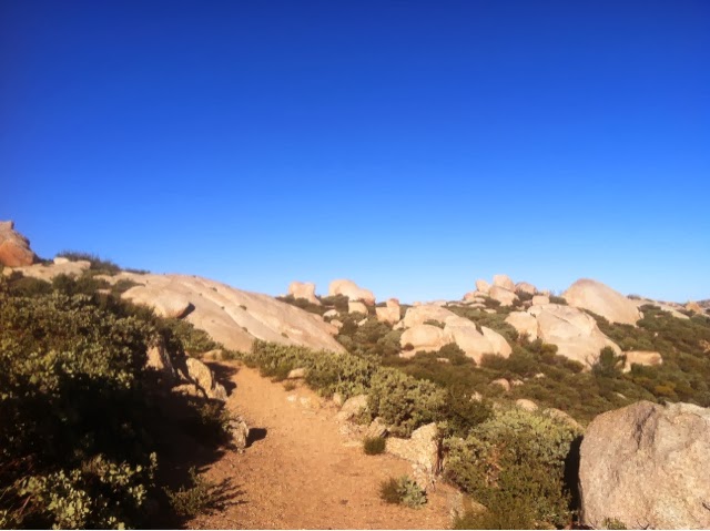
From the CRHT the trail looks like it peters out and I kept checking my maps to be sure I was on the correct path. This doesn't look like my trusty PCT. 

  It bottomed out in a flat wash and followed old rutted Chariot Canyon road up a winding hill then shot off to the left and finally I was on the PCT trail that I recognized and trusted. 
The folded hills were lovely.

No Robin in sight, I opened my phone and had a message from him that neither road was passable. No cool drink in an umbrella chair today, sniffle, sigh.  Yep, spoiled. 
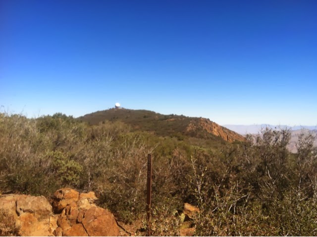
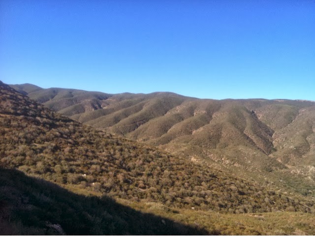
I rounded a hillside and could see this mountain come into view, looking on my map it's named Chariot Mt.   Far below you may be able to see a road at the base of it. I thought maybe Robin might be able to find a way in by that road.     No dice.
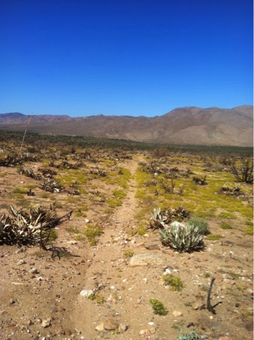
After Chariot Mt The valley floor starts becoming apparent.  The day is heating up, I'm glad to have my umbrella with me.  I've brought 3 liters of water and am being careful to keep hydrated, stopping often for snacks. I've already had 2nd & 3rd breakfast!   
   There are caterpillars that are all over the trail here, eating greenery voraciously, stripping the tiny plants. They look like a type of hornworm, black and yellow stripped with a horn on one end. This is such unforgiving territory I'm careful not to step on them.  
  I'm came up to a gate of some sort in the middle of nowhere and had to chuckle to see a real street sign.
Rodriguez Spur and Pacific Crest Trail! 

Also there is 1 water jug left from a water cache under a bush which I past up.
The trail passed across the road and continued down the valley. The flat valley floor is far down the hills and I know Scissor Crossing is down there somewhere and so is Robin, waiting in the sun for me.
The trail is dry and shows damage from a recent rainfall,  cutting gullies and gashes across the trail.  Tossing rocks and debris down the washes.
A text from Robin tells me it's 92 degrees
which explains a lot about how I'm feeling just now.  I stopped in the lee of a bush, using it and my umbrella for shade, I ate more and drank more. My Gatorade is actually hot. 
The last miles are always a beast and when I think I'm close... Well,  I should know better. 
Descending these hills the trail is covered with a weed that collects on my shoes, my socks and eventually works it's way inside my shoes to poke at my toes. nasty weeds.
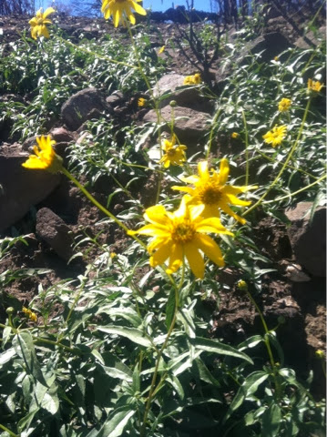
  I think after the brief deluge a week ago, the weeds sprouted and tiny yellow flowers bloomed which I can still see examples of along the path. 
At last I stepped off the hillside and down onto the valley floor.  Immediately I lost the path in a big wash of soil, rocks and debris that flowed off the mountains in the rain.  It washed away the trail and I cast around trying to find it finally climbing a hillock, getting high enough to survey the surrounding area.  I saw it going off in one direction so I had to note where I would pick it up, otherwise I would lose it again in all the sameness of the desert sand. 
This is the trail going through the bloom of tiny yellow flowers.  Somewhere out there is Robin waiting for me at Scissor Crossing. 
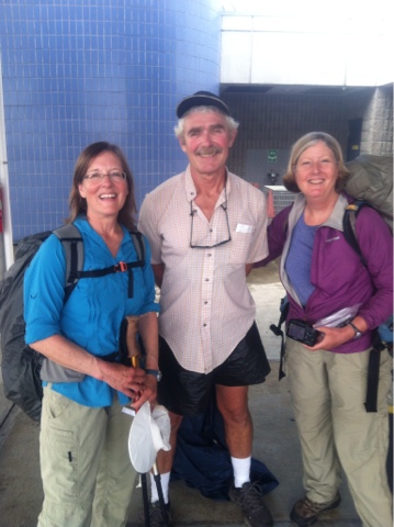
I struck off into the distance and after a mile or so I heard my name called, I answered and Robin and I found each other in the desert, he was carrying a cup of iced cranberry juice to me!  Wow, nothing ever tasted better!  We walked about 1/2 mile together until we came to his cooler and umbrella chair under a tree.  It was too hot to rest for long, we packed it all up and trudged to the car parked along the Hwy at Scissor Crossing. 
Robin really had to work to find all the trail crossings out in the middle of such a wild expanse. But he not only found the trail but brought drinks and snacks!  
We drove to Julien for a big lunch to celebrate.  Great food in Julien!
After spending a last night at Burnt Rancheria we left Southern California for other adventures together.  
Next year Peggy and I will meet in the desert and hike the state together, minus these miles of S. Cal. I've already hiked. California is approximately 1500 miles and we will have completed the Pacific Crest Trail.  Wish us luck and follow us at this journal in April 2014!

A Short Hiking Day but My Favorite So Far

9/23/13
PCT mile 52.5 - 59.5   8 miles
From Pioneer Mail to Sunrise Trailhead

We both had a good nights sleep, not too cold last night.  We got up at 5:45 am and had breakfast outside, drove to Pioneer Mail where I stopped hiking yesterday and got on the trail by 6:45. 
  Driving to the trailheads in the morning we both enjoy the dawn breaking over the Anza Borrega Desert in rich gold tones. There was a good breeze starting off today so I had my extra fleece on for warmth. 
This is my morning shadow hiking with me. 

This is the Pioneer Mail road that the PCT borrows for a shot while, walking in the golden morning light is a delight. 
The Anza is wrapped in shadows but not for long as fingers of light pry into it's chilly corners.
I soon stopped to shed my fleece layer and enjoy the chill on my warm skin.  Every curve in the trail was a thrill today. These rocks were all over the hillsides, the trail wound in, around and through them. I wanted to climb up on them and see the world from each new vantage point but hiking alone, that would not be a good idea. 
I love how the folds of the mountains hold the shadows.
Iron deposits make pictures on these big white rocks. 

All too soon the 8 miles were finished. I saw no one on this stretch and loved every minute of my solitude in this beauty.  Robin met me 2/10ths of a mile from trails end and we lugged back a beautiful stone with pink deposits running through it for the garden. 
8 miles in 3 hours, it makes a big difference not carrying a full pack!

Blown Away!


9/22/13
Burnt Rancheria Campground
Mount Laguna

During the night winds began blowing, and blowing, and BLOWING!
I slept only 2 hours, Robin finally went into the car to try to sleep. I was afraid at times that we would be blown away, poles snapping and the tent ripping to bits.   We'd staked the tent into the ground but now they were bent, useless, but at least they'd held fast. The fly attachments were whipped into tangles that I occasionally caught hold of by unzipping the tent door and extending my hand as they whipped around.  The tent would lift, crash down and mush side to side in the blasts, I had visions of a tree limb coming down on my head.   At first light I packed my gear up because I was sure we were leaving at the first opportunity. I raced out to the car to talk to Robin, noticing there was a blanket of wet fog all around, he suggested we go get breakfast in Julien 38 miles away and off the mountain.  As we drove north across the Laguna Mts we drove right out of the fog and into a lovely sunrise. 
Literally, we drove out of this cloud bank.

The morning light was gorgeous! 

We heard on the radio that the winds were 34 mph and I wonder if they weren't the Santa Annas that are known to kick up in this region.  
Our breakfast finished, we drove back to our camp in the clear morning and I packed a light pack with food & water and set out for an abbreviated hike.  Since I'd gotten a late start I would only go 11.5 miles today to Pioneer Mail Picnic area. The name comes from an early mail route using an old road that the PCT borrows for a short while.  I started off by the Desert Nature Trail where I'd hiked yesterday and skirted the campground actually coming quite close to our campsite where there was a water fountain in the middle of a clearing. Nice to know for future hiking up here. 
This is an observatory on government property just off the PCT.

 I past a picnic area with tables that would take a hiker to the community store and post office for resupply packages. (but I have my own personal trail angel to help me with resupply. Thank you,  Robin! ) Soon I was in a burned area, really stark, everything was burned, even the dirt. My umbrella was a life saver as there was no shade to be found. I met a few people day hiking and at times could see the road and cars. Coming off of a hill, across a valley the trail came just below an observation deck burnt by the fire and closed.  Below it was a stack of patio chairs which I borrowed as I sat down and ate my lunch shaded by the deck overhead. 
Burnt desert brush. The dust coated my legs to above my knees even though I was wearing my long pants. 

Some greenery peeking through, tying to make a comeback.

I continued on, hiking just below and out of view of the road.  This time overlooking the vastness of the Anza Borrega Desert far below me. 
The views off Mt Laguna to the Anza fell away into loneliness. 

  There were quite a few day hikers out hiking around Garnet Peak where I was headed, easily accessed by a trailhead near the road.  Occasionally I  saw these small sunflower like blooms in the burnt, black earth, a welcome color burst.

By later afternoon I was tired and hot and ready for a break. I was sure Robin was just around the next corner so I started to hurry but the picnic area never seemed materialize.  On an on I traipsed, finally I saw a family and I swore I saw someone wave at me.   Still, I just kept going around corners and there would be more trail!  Finally, I saw Robin, he was above me on a ridge but I didn't think I had the energy to get up there, I hoped the trail didn't end up that high!
Another look at the Anza far down the Laguna Mountains.

Thankfully Robin had hiked up the old Pioneer Mail road to look down on the trail so he could see me coming. I didn't have to hike up there until tomorrow.  He said later that I had been traveling really fast when we saw each other. Like a horse to the barn at the end of the day I guess!
  Back at our camp spot, at Burnt Rancheria,  Robin had snacks & cold drinks for me.  We are the only campers at this entire end of the campground because it's Sunday night. It's a beautiful evening with a fire in the fire pit.  We want to go to bed but it's too early, we play a game that we have to see 10 stars before we can head to bed!  Finally, the 10th star is located.

Climbing up the Laguna Mountains

9/21/13
PCT mile 20-41.5   21.5 miles
Lk Morena to Burnt Rancheria Campground

Robin and I woke at 5:30am to the chilly darkness. I packed my gear and ate breakfast, double checked everything and Robin walked with me out of the campground to the trail. He was to pack up camp and have breakfast himself then go to a grocery and get goodies to meet me at PCT mile 30 where the trail crossed a road. 
This was my view of Lk Morena in the chilly morning at 6:45.  The cold air had created fog over the lake surface, the moon hanging in a beautifully pink sky... It was a great start!  

Warming up fast I took off my jacket and after winding around large stones, desert brush and around hills the trail descended into fenced meadowy areas, under trees and meandered across a flat valley.  I met a young man around mile 24 who looked lean and hungry. I asked if he was southbound and finishing a thru hike?  He said he'd started in Yosemite and was 24 miles from the finish on the border at Campo.  I shook his hand with a big congratulatory smile and said,  "Good Job"!    Such an accomplishment,  I knew the feeling!   
 I crossed under Hwy 8 with cars whizzing overhead then angled up beside the Hwy and I could see the trail leading over the hill and beyond.  I gained elevation so I could look back down on the trail where I'd come from and knew Robin was up ahead of me not too far away. I arrived at the road crossing suddenly, one minute I thought I was in the middle of nowhere and the next, there was our car and Robin looking for me!  He had a chair set up with an umbrella for shade, a cooler with drinks and fruit!  Now that's the way to hike!  Why hadn't Peggy and I planned our hike like this in the first place?
  I didn't stay long but oh my, the cold drink was heavenly!    I remembered we might have a small purse sized umbrella in the car trunk so I got it out and started hiking with that for shade, it was getting hot outside (in the 80s) and on exposed hillsides with scrub up to head height, not much shade available.   Three miles further there was a small track crossing the trail where I saw people sitting by a car, it looked like my car but who were all the people?   Robin had found a rough road which he crept up in the car, set up again and noticed 4 college age guys hiking toward him. He asked them if they wanted water and a sweet roll?  No questions asked, they veered over and soon were telling their stories sitting under a shade tree drinking water eating a snack when I walked up. They were going the opposite direction that I was, hiking 20 some miles to Lake Morena. 
 I didn't stay long visiting, I knew Robin would have no other opportunities to meet me today.  He was going up to the campground to set up our camp and wait for me to arrive.   I hiked most of the day by myself meeting a few people coming the other direction. This section is all uphill ascending to the beautiful Laguna Mountains. The umbrella saved me, giving me shade that made a big difference in the heat & I know I'll be buying a lighter version with mylar covering for 2014's hike.  I carried water with me and never saw any streams or anything available, one of the drawbacks to hiking later in the season.
 Climbing higher into the hills I noticed a change, more pine trees growing.  I knew I must be getting closer to the top & began to hear cars but couldn't see the road.   Soon I began to see people on the trail, then a Desert Nature Trail sign which I knew meant I was close to our campground.  When I saw a connector trail I took it and came out on a campground road so I called Robin and he drove to meet me in 3 minutes. 
  Our tent and camp were set up and the afternoon heat felt just right under the pine tree canopy.  I took a shower, what a treat &  Robin had dinner all ready to eat.   This could be addicting! 
We were in bed at 7:00pm.

From the Mountains of Washington I'll Get a Start on the Desert of Southern California

9/20/13

My husband, Robin, wanted to help me get a start on the desert sections of the PCT while it was relatively cool.  I'd started from the border of Mexico on April 21st in 2012 hiking the first 20 miles to Lake Morena  but had not done well in the heat (in the 100s.)  I'd ended up going home and hiking Oregon instead.  My good fortune was to meet Peggy on the flanks of Mt Theilson in Southern Oregon, she was to became my partner in finishing the Oregon PCT in August 2012.  Then, since we'd partnered so well, we decided to hike Washington to Canada this year and we accomplished that incredible journey September 3, 2013! 
  My hope, in driving down to Campo, was to pick up in Lake Morena where I'd left off in 2012.   I was still in shape from hiking Washington and the desert weather in September might be cooler.
 The first order of business was getting a hiking permit for the Cleveland National Forest which the PCT runs through. In Oregon these permits are free and one is able to register at trailheads. Not so in California and there are fines to go with it if you are without a permit. Usually when hiking 500 + miles on the PCT you apply for a free permit allowing access through these parks. As long as you carry the permit you are able to hike without having to contact and receive clearance through each and every park, an exhausting process. Because I wasn't hiking 500 miles I needed to apply for a local permit.   So a visit to the Ranger Station in the town if Alpine was necessary,  where we purchased permits and maps.  Then we set up camp at Lake Morena campground and following our map found a place to rendezvous with each other the next day for cold water & snacks on Kitchen Creek Road. This would be 10 miles into my hike from Lake Morena up Mt Laguna to Burnt Rancheria campground where we would tent camp the following 3 nights.
  Robin and I hadn't tent camped for years so it was fun to set up, make dinner, snuggle into our bags and plan the next day. Robin was to be my own personal trail angel and shuttle driver. 
  We had to use ear plugs to fall asleep in the noisy campground but after a long day driving it was not such a problem. 

Saturday, September 14, 2013

One Last Yogi and We're Home!

9/3/13
Manning Park to Abbotsford and over the border.

After breakfasting at 8am we purchased a sandwich to go & a drink from the cafe that would be our lunch on the bus.
TareBare met us out in front of the Lodge at 9:45 where the bus would arrive at 10:10.  Also waiting was another couple we'd last seen on Tamarack Peak who were going home to the Seattle area and two other section hikers.  Stowing the packs and poles under the bus we climbed aboard looking for a seat. We all split up to sit with folks that had boarded in other towns.
I sat with a delightful lady going to Vancouver who shared of her interesting life teaching agriculture through the Canadian Gov't programs in The Gambia.  She was very interested in my trek and scrolled through my iPhone photos asking questions as we segued through many other subjects. The skies turned dark and rain poured down as we drove by the Frasier River Valley, pretty farming countryside.  Meanwhile, Peggy was enjoying conversation with her own seat mate and at one of our stops the lady made a call to her husband.  She'd asked him to bring their larger car to come pick her up in Abbotsford because she wanted to give 3 hikers a ride to the border!
This was Peggy's seat mate, I never got their names, a very nice couple! 
Peggy's, TareBare's and my packs stuffed into the back along with our poles, they pulled into traffic zooming to the border and after a couple of miles we were stopped in a long line.  We told them to pull over so they could easily get back on the road and we would walk the remaining distance, shaving 2 miles off our 3 mile walk was great and by that time the rain was breaking up. 
We got our packs on, ponchos too and waving our trail angels goodbye we set off on the shoulder of the highway for the border which we could see was not far away. Arriving among the lines of cars we followed signs for pedestrians to go inside and present documents. 
It was a quick glance at passports and PCT paperwork both US and Canadian and we were through. There was Robin waiting by the door, my own personal trail angel, providing support and transportation to and from the trail. 
With Peggy just outside US Customs.

With TareBare and Peggy ready for the ride home.

Robin had packed a cooler with every possible goody in it for our trip home. He drove the entire way back to Medford arriving at  midnight. Peggy drove south the next day, dropping TareBare at his home to prepare for the last leg of his thru hike, Echo Lake (by Lake Tahoe) to Ashland, Oregon.

So this year's PCT hike is finished, lessons learned are tucked away, I'm grateful for the teamwork and commitment of Peggy and the love, support and understanding of my husband, Robin.
 I'm also grateful for the existence of the marvelous Pacific Crest National Scenic Trail that takes enormous effort to maintain and keep open for those who seek the solitude and wild beauty that is found there. 
Without committing myself to anything yet, the California section of the PCT still has not been finished. It could be that next year this blog will feature another distance hike from the Peggy/Jane team!

A Zero Day In Manning Park BC, Canada

9/2/13
Manning Park Resort BC

Awoke a 8:30am after sleeping like the dead, we dressed in clean clothes, (what a novel idea) and went for breakfast. 
After eating we wandered into the bookstore and looked at identification books on berries, flowers and mushrooms. Peggy found many of those that she'd photographed,  including our 500 mile marker mushroom, (it happened to be poisonous!)  I was glad to know that by washing our hands with soap we'd dodged the bullet and would not have neurological damage after all! 
 Back at the lodge I took out my tent and sleeping bag to dry them in the sun before packing things away for our bus trip home tomorrow. We relaxed and read while watching our stuff dry and TareBare came by to chat awhile.  He'd gone on a short hike to see a nearby lake, Peggy & I both wanted to go see some things while we were here but they all entailed walking and my feet just wouldn't stand putting on the shoes again. 
Later that evening TareBare met us for dinner and by 8pm Peggy & I were in our room, everything cleaned and packed for the bus trip tomorrow morning. 
Robin had answered our email and would be waiting for us at Semus, Washington just across the border from Abbotsford, BC where our bus stopped. From Google maps it looked like a 3 mile highway walk straight to the border.  All seemed in order for us to get home.

Friday, September 13, 2013

A Monumental Moment!!


9/1/13
PCT mile 2654-2660-@2669 - @15 miles
(Hopkins Lake to the PCT Monument to Manning Park, British Columbia, Canada)

Last night Walking Home arrived back to his tent from the border around 12:30am by headlamp having completed his 2,660 mile thru hike in the quiet of his own company. (Peggy saw his headlamp go by in the darkness.)
Also in the night I had a deer that clomped around my tent for a long time, I got up, gathered rocks and tried chucking them at him, clapped my hands and making noise.  Nothing seemed to faze him.  He seemed big and scary until the moon caught him just right and threw his silhouette on my tent. I could see him chewing, tongue flicking in and out and his head dipping down to grab grass and paw the ground.  I tried to count the antler points but couldn't get a long enough look.  I could hear him breathing he was so close!   When I saw the silhouette I laughed out loud because if he was this close I knew no other animal could be near, suddenly I felt safe & sound!   Not long after that he wandered away and I fell back to sleep.  Lots of things walking around here in the dark this night!
We slept almost to 6:30, I woke and watched the sun rise upon our camp and touch the mountains with light.
Within today's first mile we'll  celebrate our 500 mile mark.  
It was cold in the shadows this morning as we started hiking but we soon reached mile 2655, our 500th mile,  which we carved on one of the huge mushrooms we've been seeing over the last few days.
We used soap to wash our hands in a stream in case it was poisonous. (On hindsight we both agreed we should not have handled it not knowing if it was deadly). Peggy has been taking lots of photos of mushroom all along the trail,  given her work in biochemistry and special interest in plants, she'll be identifying these once she get her hands on a computer and plant identification books.
Our enthusiasm for the completion of the trail waned as the trail went through wet brush and overgrown, potholed trail. I countered the annoyance of wet pants, shoes & socks by eating huckleberries. Peggy told me not to touch them in case the poison was still on my hands, so I grabbed the bush and ate them off the branch!  Never say no to a full berry bush.
The sky was blue and the air warming up, the trail wound in and out of forest and brush but there were  no vistas from mountain tops today.  I kept a lookout for any sign that we were getting close to the border.
This is the first sign we came to at Castle Pass. Still some miles to go before the border though. 

 More ho-hum scenery and then, there it was, a clear cut line in the forest disappearing over the mountain to my left, it had to be the line between the US and Canada.
My heart started to pound, I knew we were close and I picked up my pace without realizing it. 
Rounding a turn in the trail, in the shadow of the trees was a wide spot, nothing really to announce itself, was the monument.
In the above photo, the sign facing me on the right was the Canadian welcome sign. In the middle was the monument for the border agreement (under the base is the PCT book to sign for the year's hiking roster) on the left is the PCT Monument.
The writing says Northern Terminus Pacific Crest National Scenic Trail.
We accomplished our goal at around 11am, hiking the state of Washington at around 505 miles!!   Yahoooo!!!
We left the monument and hiked into Canada taking a nice lunch break at a river in the sun. 
The remaining miles to Manning Park were on a narrow trail in the forest over a few mountains and down into the Park. We met a few Canadians hiking for the day or weekend, this is Labor Day weekend for them too. At last we arrived at a road and stepped onto the shoulder to walk .7 miles to the lodge, a room, a shower, laundry and a celebration!
Tired but happy to have arrived in Canada!
E-mail notes were sent by Peggy to family as we waited for our rooms to be ready. Maybe it was because I knew we didn't need to hike the next day but I could hardly walk my feet ached and felt bruised.  We saw another hiker walking by and had him join us for lunch, it was TareBare who we met in Stehekin. He'd arrived two days before. We made plans to transport him back to Medford with us. 


Wednesday, September 11, 2013

The Washout

8/31/13
PCT mile 2663-2654  -18 miles

In addition to wearing everything I owned last night I breathed through a wadded up bandana because the air was so cold.
At 5:30 when I awoke I knew that the tent would be wet inside from condensation because it had been so cold.  I used the micro fiber towel to wipe both inside and out before packing up. 
We were hiking at 7:00.  I wore my down jacket but only for 10 minutes until  I warmed up on the climb to Jim's Pass where early morning sun was warming the air.
The trees behind me are tamarack trees.

Down into the next valley we stopped in the sun by a small stream and were joined by a couple who camped there last night.  They were hiking into the Pasayten River to fish for the day. I showed him my Topo Map app and Halfmile's waypoints loaded on my iPhone so he could get an idea of how the system works, he was very interested in the apps for his own treks into the backcountry.
We knew that we would be approaching the reported slide area and potential  alternate route today so we were surprised when we got to the Holman Pass Trail junction not to find any info about the alternate.  Last year when hiking Oregon, the fire on Mt Jefferson prompted all sorts of signs for the alternate trail around the fire. Washington is much more remote so that may be one reason no one had posted maps.
We decided we would continue to follow the PCT and take our chances as others were doing, reports were that it was very doable.   We climbed up and up to a high meadow just below the pass to take our lunch, each grabbing a liter of water from the spring nearby. 
The pass is around the last group of trees.
 Upon reaching the pass we got a glimpse of the next valley, broken rock peaks, rock scree everywhere, downed trees lying where avalanche had left them, grey and bone dry.
Looking down and right from the top of the pass you can see some of the switchbacks we would be taking on our way through this area. 
Looking left to where we are going over Woody Pass, that is Powder Mountain (far left in shadow) whose flanks are scored by the slides that can't be seen from this angle.

We began switchbacks down the rocky slope on the exposed hillside, stepping over places where mudslides had piled up in the trail. As we got across about half the long traverse we began to cross slides gradually getting wider and deeper. Until we reached the biggest one. You had to climb down into it at a sharp angle and once in it, it was probably 6-8 ft over our heads, you had to get a foot hold and scramble out of it. The sides were sort of moist and the mud held together but some sloughing of dirt and rock was very possible. The faster you got out the better. 
Which is why this is the only photo I got, once I got out of it!
Peggy decided she didn't have the flexibility to climb up the steep sides so she thought going down the mountain slope more toward the bottom would help her get in and out better. What ended up happening once she'd slid down the bank into the gully, was,  the soil was loose and crumbly,  big rocks less stable and couldn't be trusted as handholds. She could find no way out that wasn't dangerous.  I could only stand up on trail and watch as she struggled to get up the bank back on firm ground. It was hard, scary work but she managed to throw herself up, catch her leg over the edge and crawl up the bank.  Then she had to climb yards up the rocky slope to where the trail was.   Words can't begin to describe how challenging the slides were, it took all Peggy's concentration and effort to get through it.  I was so proud of her and the hard, hard work it took to get through this section. We had been fretting about getting around this steep slide for days and now it was done.  We both took a minute for tears, bleeding off tension and fear, then pulling it together said,  "Let's get off this mountain."  We had 2 more gullies to face, each less challenging but still unnerving that we had to climb into and back out again. Then we zigzagged up to Woody Pass where Peggy faced her nemesis in a moment of introspection.
Peggy is down trail from me on the switchback, the slide area in shadow.

The next few miles we chose to hike to put ourselves in position to get to Canada the next day, one day earlier than planned. Although Peggy was exhausted from the anxiety of negotiating the slides we both dug deep and found enough energy to get to our camp. We still had quite a lot of exposed, rocky trail to hike. We came around this mountainside and across the boulder field,
into new valleys and lake basins.
The trail curved beside The Devil's Staircase and a drop away close to the narrow trail that made me dizzy if I looked too closely. (It's the shaded rock in the middle that's called the Devil's Staircase)

Finally we could look down at the basin that held a tiny lake and our campsite. 
We arrived at 6:30pm and set up camp. Walking Home had camped there too but he had left to hike the 7 miles to the border and back, he wouldn't cross over into Canada but turned around the next day and hiked back to Hart's Pass, home to Winthrop, Washington.  We ate dinner at 7:30 as darkness was falling in the basin, sun casting alpenglow on the surrounding peaks.  We'll be sleeping in til 6:30 tomorrow!  We have 7 miles to the PCT Monument and the Canadian/US border, then 8 more miles to Manning Park, Canada where we'll rest and look into catching a bus to the USBorder!! I can't believe this is our last night on the trail. 


Sunshine To The Rescue!


8/30/13
PCT mile 2620-2636 -  16 miles 

5:30 wake up, it rained all night and in exceptionally hard rain my tent sprayed condensation onto my face.  Last night,  in an effort to warm up from the wet and cold, I was in my silk sleep sack inside my down bag, wool hat, long sleeved sleep shirt, down jacket & wool socks on.
As I warmed up I moved my down jacket to my feet to warm them and then to various cold spots until I was all the way warm.  In the morning I called out to Peggy that I wanted to get to Hart's Pass and see if we could get a ride to a town and dry out. I was honestly thinking that I'd had enough of the rain. Peggy was agreeable, hoping that something would break and change my mind. 
I rolled up my tent, wet inside and out, stuffed my damp sleeping bag and everything else that was damp inside my damp backpack, put on the poncho and pack cover and we started hiking in the continuing rain.  Coming out of the forest we began a long hillside traverse and switch back up to Glacier Pass.  The views would have been beautiful but in the rain and swirling clouds I only got a couple of photos. 
I'm higher on the switchbacks looking down at Peggy as we climbed from our campsite up to Glacier Pass in the wet greenery. 
Ducking over the pass to get out of the wind and rain we watched clouds pour from one valley into another.  This pass had some nice campsites tucked into corners and on a clear evening would have made a picturesque place to camp. The area on top that we walked through was unusually stark, just low growing moss and ground cover and a type of tree I can't place. 

 The tree was sparsely needled in light green tufts, many of the older trees had branches like a deciduous tree. (not the Eiffel Tower shape of a fir tree.)

Crossing a cinder cone, over a short ridge walk (see the path on the ridge below)

we turned into a basin and met a woman our age going south, solo hiking for 10 days.  She was from Washington and was used to camping in rain.  I asked her the weather forecast and she said it was supposed to get better but that in Washington one never could be certain. When she found out that we'd started in Cascade Locks she told us we were "Gnarly Women!" and not to let the rain get the best of me.
These streaks were mud slides that made small gullies for us to negotiate. The trail crossed that hillside just above the trees.
As we rounded another mountain coming into a boulder field the skies looked to be clearing, big patches of blue sky coming our way.  We decided to unload our packs and use the warm boulders to lay our stuff out to dry. Everything we owned was laid out so that we looked like we were having a rummage sale!
It took a good hour, turning, fluffing and shaking things out.  Because we were close to Hart's Pass there were day hikers who began to walk by.  One group of ladies walked up and I heard one say "I know you!"  It was the lady,  the Canadian couple that we'd  talked to at Red's Pass days before!  We gave one another a big hug like we'd known one another for a long time. 
Jude, my friend from Red's Pass, is on the far left. 
She remembered me saying I craved apples so they found an apple in their packs that they gave us! This was a really encouraging moment for me because I'd been in my "rain funk" and discouraged with the trail. We exchanged emails and they continued their day hike south. 
We sat and ate the wonderful apple, repacked all our DRY equipment (and put my worries away).  We did a little happy dance in the trail, I made a sarcastic remark to which Peggy said "Jane's back!"  It gave me pause to think about how mental this hike is, how close I'd come to wanting to get off the trail and just how much I needed a pick me up! 
I've come to think of yesterday as my "Terrible, Horrible, No Good, Very Bad Day."!
Hart's Pass was a few miles further.
(See how far to the Canadian Border?)

When we got to the Ranger Station we were told there was trail magic for hikers at the picnic table.  There was Walking Home and a group of locals from Winthrop who had come to meet him and celebrate his almost finished through hike!  They had brought sandwiches, peaches, nectarines, brownies, hard boiled eggs, bottled water, chocolate, cantaloupe and more wonderful food for hikers and we were invited to partake!  Walking Home's friends were welcoming and great to talk to and we had a good lunch there. 
There were still some miles to go to our camp so we left the Ranger Station for Hart's Pass and beyond. There were many cars parked at the trailhead at the pass and as we hiked north we met families hiking back to their cars.
From Hart's Pass the terrain is rolling, grassy, with fir, pine and these new trees. Really pretty.
Looking back toward Hart's Pass we can see the snowy peak in the middle near Glacier Pass where we camped last night.
The view of mountains west of our trail and Hart's Pass.

 I talked to one family hiking back to their car, asking them where they'd hiked?   "Tamarack Peak" I was told.  It struck me that the new tree I was seeing was a Tamarack or a Larch.  Lining the trail up to Tamarack Peak they'll turn a glorious gold color and drop their needles before winter, the only fir tree I know that does that.
A new trail sign told us we were going into the Pasayten Wilderness and only a few miles further we were at our camp on the back side of Tamarack Peak, a cold spring flowing by our tents. 
It's going to be cold and clear tonight at 6500 feet elevation. The sun is setting sooner in these last days as September is upon us, dinner took a bit longer to cook due to altitude and we were in bed earlier, journaling by headlamp before 7:00.   In the night I woke up and could see the Big Dipper hanging just above the trees outside my tent, beautiful!