Pages

Monday, August 22, 2016

8/18/16 Thursday to 8/22/16 Monday

8/19/16 Thursday
We met our friend, Nitro Joe, at his motel and joined him shuttling to Molas Pass.
As the 3 of us started hiking we ran into about 20 trail crew doing work on the trail.  We made sure to personally thank each one for their contribution to our hike. We began to tackle the climbs and said goodbye to Nitro Joe who hikes fast.
Redbeds layered with white rock & in the foreground, conglomerate  boulders.

  By the time we started up another pass it had started raining in earnest. During a hard hail we sought shelter off trail under a big tree until we could see if the weather was safe for us to hike in.  We determined it was ok so we got back on trail.   We'd brought leftover pizza to eat at our break and it was delicious!  We crested a pass in the cold, pouring rain. Our shoes, pants, gloves and parts of our shirts were soaked. As we dropped onto a new valley the clouds lifted and small lakes could be seen in the distance.  We were both cold whenever we stopped, the wind was blowing but it was great to think we might get out from under this rain.
We stopped for good in a small campsite near a waterfall. We got our tents set up and dinner eaten without rain falling. Because our feet were soaked they were really cold & we both had trouble warming them up again.
Didn't take many pictures today because it was too cold & wet.
We shared our camp site with 5 other hikers who came in after we were inside the tents for the night. We usually camp in solitude but there are not many places available in this section.  Hiked 14.7 miles & camped at 10,912 feet.

8/19/16 Friday
We crossed two streams like this one.  Every stone or log that rested in the water was covered with white. Peggy said it's calcium carbonate from mines upstream. 
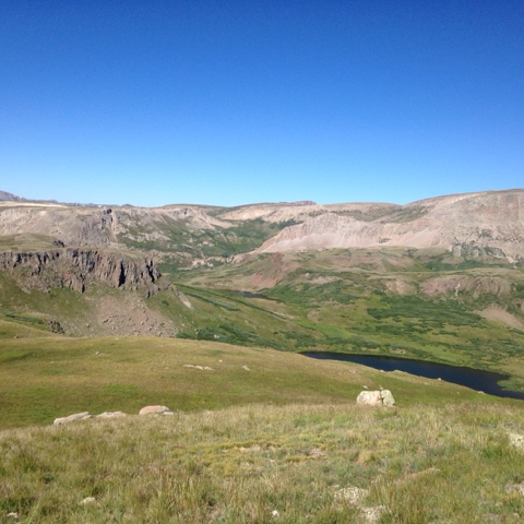
The trail climbed up over a slide rock ridge and entered the beautiful meadowed Tin Cup Basin. Far off in the distance were the sharp teeth of the Rockies and the famous Lizard Head Peak. 
Lizard Head Peak is hard to see but is just above the trail in the distance.
Peggy filling up on water from the lake at Bolam Pass.
Climbing by cliffs called redbeds we saw very rich red soil and rock.  

We came to a basin where we knew we'd have to climb out but neither of us could see how.  
Blackhawk Pass.  You can't see but there are switchbacks that go right over the low spot.  The wildflowers were beautiful in this basin.
Field of flowers.
Just one step over Blackhawk Pass the trail can be seen moving down the peak. This was a beautiful example of the redbeds.
A look back at Blackhawk Pass and CT sign.  We found water in a ravine that was our last water for 22 miles.  We both pulled 4 liters out and thank goodness only had to go 1 mile to a campsite. Carrying 8 pounds of water was tough to do.
Hiked 15.1 miles camped at 10,797 feet.

8/20/16 Saturday
Being at this elevation we knew it could be warmer in the night and it was.
Today we wound through the forest and out to hillsides covered with corn lily.
Peggy, dwarfed by tall corn lily.
Blue gentian surrounded by purple asters.  A whole mountain was covered by these flowers in peak color.
A look at our back trail.
This is a waterless section, we're each carrying water for the day, water to cook dinner with and water to start the next day with. There were 2 places with possible springs which we searched for to no avail. 
Oddly, someone had written in charcoal on a tree the word WATER.  So I checked it out and found a trickle that I scooped up with a Baggie filling 2 liters.  Peggy was just starting to look for a spring when I hiked up to her.  Now we could drink when we needed.  We were both thirsty.
Overlook Trail was our campsite. We walked to the overlook located at the end of this shale covered mountain top. We can see in the distance the mountains we covered in the last two days. At 8 pm we heard a whole chorus of coyotes!
Hiked 14.2 miles camped at 11,358 feet.

8/21/16 Sunday
Sometime in the night the wind came up the mountain like a train. Luckily we were tucked away and didn't get in it's path.
Today we climbed up and up to crest the mountain and walk along the ridge top.
We walked along the top of this ridge, I like to look back and see where we've come from.
Topping out we saw these amazing peaks. This is the start of Indian Ridge, an exposed ridge walk with amazing views.
Hiking higher, a look back at the same ridge.
Next to be tackled is this mountainside. See the trail going up and over.
Once over the top, there's more to climb. 
The shale that makes up the foreground mountain top is slippery and hard to walk on. 
We had to climb up this narrow rocky connection to gain the top and switchback down the back side to Taylor Lake,  a rocky trail with drop offs on either side.  
This is the approach. 
Taylor Lake where we got water.
Clouds began to collect so we hurried over the Kennebec Pass Trail to see this old miner's cabin on the top of Sliderock Canyon.
This is the downhill trail off Sliderock Canyon. Can you believe mountain bikes ride this too?
Rain began in earnest as we made our way down, down, down from the ridges.
These are Mexican Hats growing tall against the wet rocks. We found a campsite by Junction Bridge.
Set up camp and ate dinner in a rain break. Once finished eating it started raining hard. We settled in for our last night on the Colorado Trail.
Hiked 14 miles camped at 8,559 feet.

8/22/16 Monday
Woke to scattered rain but we were able to pack up as the rain stopped.  Today is our last day on the Colorado Trail, only 14 miles to the terminus. 
The wet vegetation growing close along the trail meant we might get pretty wet walking out. It was a forested walk, first climbing 1,000 feet then pretty much downhill most of the way.  We stopped a few times to snack and arrived at the bottom amid groups of local hikers or tourists interested in our Colorado hike.  We talked to a few of them and one lady offered to give us a ride to our Durango
Inn. 
Completion!  About 6 weeks - 486 miles
on the amazing Colorado Trail.


Wednesday, August 17, 2016

8/13/16 Saturday through 8/16/16 Tuesday and 8/17/16 zero in Silverton, CO)

Peggy said she shivered most of the night plus we saw no sign of the Perseides during the night.  Hiking early, we wore down jackets, gloves & hats for warmth.  Peggy was fatigued having shivered away energy reserves during the night. 
We reached the Continental Divide and ranged near it most of the day at or above 12,000 feet eventually reaching the Colorado Trail high point of 13,271 feet.
Looking over the Divide
Sheep grazing the Divide pasture lands.
Proof that we made it this far!
Looking at our back trail.
Peggy is taking a picture of a ptarmigan perched on the rock above her tent. It was a mama gathering her 5 chicks who foraged between us. Camped at 11,983 feet. Hiked 13.5 miles.
Great camouflage for this ptarmigan chick.

8/14/16 Sunday
Today was my day to lack energy.  The trail started off going up over 12,900 feet. On the way out of this valley looking down into the creek basin we saw 2 moose, possibly an elk in the willows, and a weasel.  
Looking back down the valley where the moose were.
These are tufas, volcanic ash that hardened and make interesting sentinels on the hillsides.
This lake is one of our water sources.
There were so many gorgeous sights today, these sand colored areas were actually granite rock that turned blue or aqua in varying degree. They were fascinating and Peggy thinks possibly a chemical reaction to rain? 
We then dropped way down into the valley and marched all the way back up again over into another basin. We did this 3 times- up and over 12,900 feet each ascent. 
Up and over the cream colored area where the pass is. Cairns mark the way in these large expanses.
We tried to find a camp spot out of the wind but there just was no cover above tree line (This is a dry pond bed.)  The wind died down after the sun set.
We only made 10 miles today, lots to see and some places where we allowed ourselves to linger. 

8/15/16 Monday
We are 1/2 day behind schedule but plan on hiking resolutely today- no dawdling!
As we hiked we realized we had a great camp spot last night, really no good sites in the next few miles had we chosen to hike further.  On the wind I heard lots of bawling, rounding the mountainside I saw a hillside full of sheep being herded together and possibly moved. They looked like tiny white dots.
Paintbrush continue to add cheery color in the meadows now that many of the wildflowers are dying away.
I'm stepping over the headwaters of the Rio Grande River.  We got clear cold water from the stream. 
Fireweed was growing along the road to Stony Pass which was our trail for .4 miles. We exited the road and walked down past the patches of snow to find 
the remains of a miners cabin and mine shaft dug into the hillside.  These are silver mine tailings and on top of the tailings were ore car rails. The shaft had snow covering the opening.
These sunflowers were so bright and welcoming among the dead wildflowers I couldn't pass them up. 
Storm clouds gathered all day, the quartzite peaks are Arrow and Vestal peaks. We'll be near them tomorrow.
As we hurried to avoid the rain we crossed paths with a couple out for 16 days with llamas. 
The trail noodled in and out of rolling hills at 12,000 feet. Occasional raindrops fell but we pressed on, always aware of our exposure to lightning above treeline. 
Here is where the trail splits from joint CT/CDT to CT.  We followed the Colorado Trail uphill and the CDT turned the other way. 
There is another trail junction that is easy to miss and in our haste to run from the rain we might have overlooked the turn but Peggy read the sign and we consulted the GPS maps. Yes, our trail was dropping right off the mountainside!
What we couldn't see from this point were the 18 switchbacks that stepped down the face of this steep decline. 
The lakes were intriguing but they were off trail on a granite cliff and we were being chased off the mountain by rain and rolling thunder.  
Almost off the switchbacks the rock face to my left showed these amazing mines dug all along the wall.  This is the Elk Creek drainage, a steep valley between two incredible rock faces. Narrow and intimidating it was accessed by miners, their mules carrying everything they needed to set up operations.  Pack trains still come and go by this narrow, rocky, steep trail. Peggy and I wondered how they did it, we found it pretty dicey for the two of us!!
3 feet of trail under the looming rock wall, a fall of loose rock on the outside descended to the creek that was gathering force in the falling rain. We had on our rain gear and were praying for good footing.
Peggy descending carefully. 
A look back at the slot.
Columbine where you least expect them to grow.
We stood on the opposite wall of the canyon in awe of the stunning scenery. Listening to the roar of the water as it fell hundreds of feet to the valley floor. 
Just another huge quartzite rock, worn smooth by glacier, looking at us as we wound down the canyon along the ledge of the opposite wall. Every turn was stunning but we were hoping to find a campsite further along and down near the bottom where the stream was running.
Eventually we did enter the wet lower reaches and found a camp under the trees away from the stream and condensation.  It rained a slight amount after camp was set up and dinner eaten. But no other rain fell. We had made it! Now that was a full day.

8/16/16 Tuesday
It never rained last night and is clear this morning as we hiked by the pond framing Vestal (or Arrow Peak).
Here we celebrated our 400 mile mark that we reached somewhere the day before in the rain!

Peggy eating wild raspberries along the trail.
A narrow gauge train runs between Silverton and Durango in these beautiful remote mountains.  They have kept them running and now are a tourist attraction. We could have caught the train from the trail. Instead we are hiking the trail to town.  We did cross the tracks and while getting water heard the whistle of the train approaching. We dropped everything and ran back to catch it coming around the bend smoke belching as it passed us! What fun that was!
This is actually a picture of it parked in town.
Arrow or Vestal peak dominate the terrain and valley where the train crosses the trail. Our path took us up a huge climb, over a peak and across to Molas Pass. By the time we reached the highway it had started raining. Peggy tried hitchhiking while I talked to tourists at the rest stop.  One couple from New Jersey were not going to Silverton but when they passed us hitching in the rain they honked the horn and said "Hop in, we'll just take you to Silverton anyway."  So 6 miles later we were dropped off in front of a motel and we found a place to stay.  Most of the Colorado  towns have busy summer schedules and have no vacancy signs, a stressful issue for us coming into town.  Peggy has had good luck trying to get service at a pass to reserve a room before we get to town. Today was too rainy to try searching the web.  Despite that,  we ended up at a B&B (sadly they offered no laundry facility.)   After lunch laundry was the next job and then we could relax,  rest and begin the chores of resupply. 
8/17/16 will be a zero. We've arranged a shuttle out to the trail with a hiker friend the next day.