Pages

Wednesday, April 23, 2014

4/20/14 - 4/23/14 From oak savannah to the desert. From beautiful flowering Yuccas to snakes.

We were thinking of leaving the Warner Springs Community Center when they announced last call for cheese burgers. Our hands shot up!  No need to cook  a camp dinner if we could go out with full tummies from Warner Springs. We got on the trail at 4:30pm traveling through oak trees and meadows, working our way into foothills up to Agua Caliente Creek and campsites by 7pm. We got tents up, filtered water for tomorrow's miles (which we hear are to be pretty warm) and tucked into bed listening to choruses of frogs.
Our tent site under a huge Live Oak Tree.

4/21/14 Monday   12 miles
Resting along the trail

Today it feels hotter that it has been, we took a breather by the trail, drank Gatorade and hiked on. We entered more desolate desert areas filled with granite boulders. 
Peggy & I both use Golite umbrellas which have proven helpful in the hot sun.

Just after this photo was taken I saw a 2-1/2 ft garter snake,  I'm glad I saw it because after that I began to be more vigilant than I'd been previously.
Needing more breaks due to heat but trying to get some miles done while we were able, we traveled into a huge boulder strewn valley & met a couple struggling in the heat too. They were from Yellowknife, Canada & hiking the PCT. We'd seen them in Warner Springs. After a bit I was walking along between boulders &  heard a loud rattle, I knew it was a rattlesnake but I couldn't see it... I danced around and eventually fell into a bush on the uphill side of the trail, I just knew I was falling into that snake.. I was a goner.   Peggy grabbed my hand and hauled me up as we backed up the trail. The snake was just off trail on the other-downhill side, I never could see it but it was sure loud.    Once the adrenaline rush subsided, we dashed away up the trail, nervous energy flying around, glad to have escaped CERTAIN DEATH.  I think of the episode as Shake, Rattle & Roll. 

I actually saw another rattler an hour later 3 ft ahead of me lying stretched out in the sun.  This time I stopped quickly and the snake slithered off the trail rattling as it went & Peggy saw it too.  After 3 snakes that day I was ready to be finished hiking.  We found a grotto of shade and holed up for an hour then made the final 3 miles to a water tank.  This tank &  property is owned by a man who allows hikers to use his water, pitch tents in his yard,  and for a fee, he'll serve dinner.  It's a welcome oasis in the desert.  We put up tents, chatted with other hikers and had a decadent lasagna dinner. It was a long hot day but we ended up having good conversation with the couple from Canada. 
This doesn't look like desert but it is.  Very dry, boulders with chaparral, cactus and some surprising wildflowers.

4/22/14 Tuesday.  17 miles

Peggy & I were up earlier than usual trying to get a jump on the heat. Yesterday had been a hard hot day for all of us and we all had the same idea...get up and out early. 
We climbed up to about 6,000 ft elevation and entered  part of the Anza Borrega State Park.  Pink, red & cream colored granite. I was wondering out loud what made the bright colors on the rocks so  Peggy gave me a lesson on 1 celled spores that land on rocks and consume sulphur, antimony and other elements giving off the wonderful yellow, burnt orange and bright green colors.  By the time the hike is finished I may have credits in Biology 101!
There was a breeze all day and cooler than yesterday, it was a pleasure to hike so we made good time.  We decided to pass going to a spring and opted to stop at a cistern to collect a liter of water. We stopped in the shade of a juniper tree and chatted with a man from Corvallis, Oregon hiking the trail too.  This is what a lot of the country looks like.

Back on the trail around 3pm we got to a water cache created and stocked by trail angels. It's a life saver, I don't think I can hike fast or far enough to make it without a couple of the caches. We take only as much as we need to get to the next water source,  never waste the cache water.   Peggy & I decided to hike 1 more mile and camp on a ridge of big boulders. There were about 8 of us camped amongst them and there was a pretty stiff breeze so we knew it would be a cold night.
Night fell quickly, winds were stiff and coyotes  were yipping.  Not much sleeping was going on in my tent. I was hoping the big rocks I'd carted to my site would hold my tent, no way to pound a stake in the rocky soil.

4/23/14. Wednesday.  8 miles to Paradise Cafe (+1 mile walk from the Hwy)
Brrr, cold and windy ALL night long!
Up at 5:30 hiking by 6:30 it was a while before we warmed up. Kind of boring hiking these 8 miles but we did see the result of water on the granite hills. It looked like a mini Grand Canyon.
We arrived at Paradise Cafe at 11, ordered huevos rancheros and chowed down, we were hungry girls!  Then we hitched a ride to Idyllwild with a young woman named Kathleen who gave us all kinds of information about the trees, the burned area where the trail is closed for 28 miles etc.   Thanks so much, Kathleen, for the ride to town! (here's a photo.)
Once registered at Idyllwild Inn we showered, had laundry done,  washed gear, caught up on email at the library, researched bugs, trees & plants that we'd seen, grocery shopped etc. You get the idea. It's lots of work taking a rest!
We are here 1 day sooner than expected and will take advantage of their outdoor stores and facilities to fix gear etc. and we're planning on getting a ride back south to Lake Morena to attend the PCT kickoff. There will be a water report, gear venders, opportunities to get advice from hikers who have experience hiking long distances.  Peggy wants to discuss her tent with the maker of it and maybe pick up tips on her hiking poles. 
We plan on being at kickoff from Friday- Sunday 4/25-27 and resume hiking either Sunday or Monday 4/27 or 4/28. I'll let you know!

Sunday, April 20, 2014

Bound For California

Work is finished! 
Seasonal work at the best CPA office in the world wrapped up the 2 1/2 months of my employment for 2014. 
Having my own Trail Angel supporting me has been a blessing! Robin I could not do this without your support, I love you! Your encouragement means the world.
Waking early the next morning (4/16/20) Robin drove me south for 11 hours and finished the drive the next morning (4/17/20) in Julian, meeting Peggy at the Julian Library around noon. She had started at the border at Campo 4/11, arriving at Scissor Crossing where I had stopped hiking last September after finishing the Washington section with her.
Meet up with Peggy was great, she had another hiker with her named Caty who joined us for lunch and the ride back to the trail.
Caty, Peggy and I under the bridge on Hwy 78. A hiker hangout before starting into the dry hills and 14 miles to another water cache.

 There was a group of hikers waiting out the heat under the bridge, resting and chatting. We ate bagels, cream cheese and smoked salmon before taking off 4.5 miles up the trail. 
Thanks Susan for the salmon, what a decadent treat to eat under the Hwy 78 overpass!
After 4.5 miles that evening we pitched tents in a wash and were wakened in the night by a loud border patrol helicopter patrolling the area.
4/18/20 Friday
 Caty left early and we've not seen her since, she's a thru hiker and is headed for Canada. There are lots of hikers on the trail, young and old. 
Beautiful  fuschia  colored cactus flowers and a tall Yucca plant that blooms once, releasing seeds and dies.
It started off cool and clear but heated up fast. We hiked 10 miles and stopped at 
3rd gate where there is a water cache supplied by a trail angel, no running water for miles, there is a 2 liter limit. We are all so grateful for the hard work it takes to keep it supplied, on this drought it can become a necessity. We pitched tents just in time for a thunder &  lightning storm that rained for 20 minutes and evaporated before it could really wet the ground.
 A full moon made the night seem like there was a floodlight turned on my tent. 

4/19/20 Saturday
We made conversation prior to setting off this morning with Scott from Boulder, Co who is hiking for a few weeks as far north as he can go. It soon warmed up enough for us to get out our umbrellas for shade while hiking. I need to work with my set up but shade was welcome!
We crossed the 100 mile mark today, someone else set it up and we took a photo of it.
We hiked 10 miles to Barrel Springs, a concrete trough fed by a piped spring. Tadpoles were swimming in it and of course we filtered the water! 
We rested 3 hours in the shade of large live oak trees & talked to many hikers coming through going both north & south. Scott was resting there so we picked up conversation with him as we waited out the heat. 
We began hiking again around 2:30 as the cloud cover looked enticing. Winding through boulder strewn, cactus & coyote brush covered hills we were surprised to cross green meadows with one or two live oaks standing sentinel. Really lovely.

We came to a small stream with benches made up of ground granite that looked like a good camp spot. Scott chose a spot back in the oaks and we all had dinner on a rock as the evening fell. 
It turned out to be damp and chilly resulting in a pretty sleepless night for me but I was determined to rest any way. I peeked out my tent door during the night to see the Big Dipper hanging just above me.

4/20/20 Easter Sunday!
It was cool and damp and I finally put my wool cap on during the night. We got hiking around 7am in pretty cool clear weather. After a short climb we came to open meadows with islands of big boulders . Peggy alerted to a much traveled path 40 yards off trail and we were happy to have explored because that was the famous Eagle Rock. We took time to do photos and enjoy it thoroughly. 


 Then we were on to the Warner Springs Community Center where breakfast is served at 8am and lunch a few hours later. 
We caught a text from Peggy's friends, Nanine & Francie. They were "Peggy hunting"  and close by, they'd try to meet up with us this morning!
About 1 mile from our destination we saw 2 green Easter pails by a tree filled with fresh fruit, spritzers, Easter candy and chocolates! Out from behind a tree jumped Nanine and Francie! What a complete surprise and so much fun! 
A very fun surprise on the trail!

We hiked together to the community center, rested, caught up with trail friends, washed hands, faces and drove off up the road for BBQ lunch. Made plans to possibly meet with Francie on May 10th for R&R near Wrightwood. They left us after lunch with fruit and small bags of Fritos & chips driving back to their homes and work. MANY THANKS for a memorable day!
We went to plug into the electricity at the center so left our packs and stuff on the lawn of the center. One of our friends came in to tell us the crows flew off with my 2 chip bags...well... RATS! 
We covered things up and had to laugh, it's a good story anyway! 
Our plan is to hike 6 more miles tonight, camp and try for Paradise Cafe by Wednesday. Because of a trail closure due to fire last year we will hitch to Idyllwild from the Cafe. That's the plan anyway. There is WiFi here and Peggy is updating us on the ADZPCTKO which we'll get a ride to from Idyllwild for 4/24-26 then hitch back to Idyllwild.  I'll post every few days or weekly as I can. 
Warner Springs Community Center dining room, very hiker friendly! What a great treat for us all. 

Saturday, December 21, 2013

Alone In the Desert Today

9/24/13
PCT mile 59.5-76.5   18 miles
Sunrise Trailhead to Scissor Crossing

Today I have a long day with 2 possible places for Robin to meet me.  Looking at my maps I don't think either road is passable but Robin wants to check it out for himself and we'll be in touch by iPhone. 
 We were up at 5:15 to see the sunrise and he dropped me off at the trailhead at 6:25.  It is cool, clear and slightly warmer than yesterday. 

The trail winds through hills of chaparral 
and also follows a portion of the California Riding & Hiking Trail.  
From the CRHT the trail looks like it peters out and I kept checking my maps to be sure I was on the correct path. This doesn't look like my trusty PCT. 

  It bottomed out in a flat wash and followed old rutted Chariot Canyon road up a winding hill then shot off to the left and finally I was on the PCT trail that I recognized and trusted. 
The folded hills were lovely.

No Robin in sight, I opened my phone and had a message from him that neither road was passable. No cool drink in an umbrella chair today, sniffle, sigh.  Yep, spoiled. 
I rounded a hillside and could see this mountain come into view, looking on my map it's named Chariot Mt.   Far below you may be able to see a road at the base of it. I thought maybe Robin might be able to find a way in by that road.     No dice.
After Chariot Mt The valley floor starts becoming apparent.  The day is heating up, I'm glad to have my umbrella with me.  I've brought 3 liters of water and am being careful to keep hydrated, stopping often for snacks. I've already had 2nd & 3rd breakfast!   
   There are caterpillars that are all over the trail here, eating greenery voraciously, stripping the tiny plants. They look like a type of hornworm, black and yellow stripped with a horn on one end. This is such unforgiving territory I'm careful not to step on them.  
  I'm came up to a gate of some sort in the middle of nowhere and had to chuckle to see a real street sign.
Rodriguez Spur and Pacific Crest Trail! 

Also there is 1 water jug left from a water cache under a bush which I past up.
The trail passed across the road and continued down the valley. The flat valley floor is far down the hills and I know Scissor Crossing is down there somewhere and so is Robin, waiting in the sun for me.
The trail is dry and shows damage from a recent rainfall,  cutting gullies and gashes across the trail.  Tossing rocks and debris down the washes.
A text from Robin tells me it's 92 degrees
which explains a lot about how I'm feeling just now.  I stopped in the lee of a bush, using it and my umbrella for shade, I ate more and drank more. My Gatorade is actually hot. 
The last miles are always a beast and when I think I'm close... Well,  I should know better. 
Descending these hills the trail is covered with a weed that collects on my shoes, my socks and eventually works it's way inside my shoes to poke at my toes. nasty weeds.
  I think after the brief deluge a week ago, the weeds sprouted and tiny yellow flowers bloomed which I can still see examples of along the path. 
At last I stepped off the hillside and down onto the valley floor.  Immediately I lost the path in a big wash of soil, rocks and debris that flowed off the mountains in the rain.  It washed away the trail and I cast around trying to find it finally climbing a hillock, getting high enough to survey the surrounding area.  I saw it going off in one direction so I had to note where I would pick it up, otherwise I would lose it again in all the sameness of the desert sand. 
This is the trail going through the bloom of tiny yellow flowers.  Somewhere out there is Robin waiting for me at Scissor Crossing. 
I struck off into the distance and after a mile or so I heard my name called, I answered and Robin and I found each other in the desert, he was carrying a cup of iced cranberry juice to me!  Wow, nothing ever tasted better!  We walked about 1/2 mile together until we came to his cooler and umbrella chair under a tree.  It was too hot to rest for long, we packed it all up and trudged to the car parked along the Hwy at Scissor Crossing. 
Robin really had to work to find all the trail crossings out in the middle of such a wild expanse. But he not only found the trail but brought drinks and snacks!  
We drove to Julien for a big lunch to celebrate.  Great food in Julien!
After spending a last night at Burnt Rancheria we left Southern California for other adventures together.  
Next year Peggy and I will meet in the desert and hike the state together, minus these miles of S. Cal. I've already hiked. California is approximately 1500 miles and we will have completed the Pacific Crest Trail.  Wish us luck and follow us at this journal in April 2014!

A Short Hiking Day but My Favorite So Far

9/23/13
PCT mile 52.5 - 59.5   8 miles
From Pioneer Mail to Sunrise Trailhead

We both had a good nights sleep, not too cold last night.  We got up at 5:45 am and had breakfast outside, drove to Pioneer Mail where I stopped hiking yesterday and got on the trail by 6:45. 
  Driving to the trailheads in the morning we both enjoy the dawn breaking over the Anza Borrega Desert in rich gold tones. There was a good breeze starting off today so I had my extra fleece on for warmth. 
This is my morning shadow hiking with me. 

This is the Pioneer Mail road that the PCT borrows for a shot while, walking in the golden morning light is a delight. 
The Anza is wrapped in shadows but not for long as fingers of light pry into it's chilly corners.
I soon stopped to shed my fleece layer and enjoy the chill on my warm skin.  Every curve in the trail was a thrill today. These rocks were all over the hillsides, the trail wound in, around and through them. I wanted to climb up on them and see the world from each new vantage point but hiking alone, that would not be a good idea. 
I love how the folds of the mountains hold the shadows.
Iron deposits make pictures on these big white rocks. 

All too soon the 8 miles were finished. I saw no one on this stretch and loved every minute of my solitude in this beauty.  Robin met me 2/10ths of a mile from trails end and we lugged back a beautiful stone with pink deposits running through it for the garden. 
8 miles in 3 hours, it makes a big difference not carrying a full pack!

Blown Away!


9/22/13
Burnt Rancheria Campground
Mount Laguna

During the night winds began blowing, and blowing, and BLOWING!
I slept only 2 hours, Robin finally went into the car to try to sleep. I was afraid at times that we would be blown away, poles snapping and the tent ripping to bits.   We'd staked the tent into the ground but now they were bent, useless, but at least they'd held fast. The fly attachments were whipped into tangles that I occasionally caught hold of by unzipping the tent door and extending my hand as they whipped around.  The tent would lift, crash down and mush side to side in the blasts, I had visions of a tree limb coming down on my head.   At first light I packed my gear up because I was sure we were leaving at the first opportunity. I raced out to the car to talk to Robin, noticing there was a blanket of wet fog all around, he suggested we go get breakfast in Julien 38 miles away and off the mountain.  As we drove north across the Laguna Mts we drove right out of the fog and into a lovely sunrise. 
Literally, we drove out of this cloud bank.

The morning light was gorgeous! 

We heard on the radio that the winds were 34 mph and I wonder if they weren't the Santa Annas that are known to kick up in this region.  
Our breakfast finished, we drove back to our camp in the clear morning and I packed a light pack with food & water and set out for an abbreviated hike.  Since I'd gotten a late start I would only go 11.5 miles today to Pioneer Mail Picnic area. The name comes from an early mail route using an old road that the PCT borrows for a short while.  I started off by the Desert Nature Trail where I'd hiked yesterday and skirted the campground actually coming quite close to our campsite where there was a water fountain in the middle of a clearing. Nice to know for future hiking up here. 
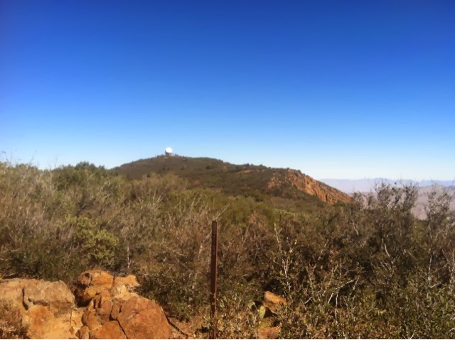
This is an observatory on government property just off the PCT.

 I past a picnic area with tables that would take a hiker to the community store and post office for resupply packages. (but I have my own personal trail angel to help me with resupply. Thank you,  Robin! ) Soon I was in a burned area, really stark, everything was burned, even the dirt. My umbrella was a life saver as there was no shade to be found. I met a few people day hiking and at times could see the road and cars. Coming off of a hill, across a valley the trail came just below an observation deck burnt by the fire and closed.  Below it was a stack of patio chairs which I borrowed as I sat down and ate my lunch shaded by the deck overhead. 
Burnt desert brush. The dust coated my legs to above my knees even though I was wearing my long pants. 

Some greenery peeking through, tying to make a comeback.

I continued on, hiking just below and out of view of the road.  This time overlooking the vastness of the Anza Borrega Desert far below me. 
The views off Mt Laguna to the Anza fell away into loneliness. 

  There were quite a few day hikers out hiking around Garnet Peak where I was headed, easily accessed by a trailhead near the road.  Occasionally I  saw these small sunflower like blooms in the burnt, black earth, a welcome color burst.

By later afternoon I was tired and hot and ready for a break. I was sure Robin was just around the next corner so I started to hurry but the picnic area never seemed materialize.  On an on I traipsed, finally I saw a family and I swore I saw someone wave at me.   Still, I just kept going around corners and there would be more trail!  Finally, I saw Robin, he was above me on a ridge but I didn't think I had the energy to get up there, I hoped the trail didn't end up that high!
Another look at the Anza far down the Laguna Mountains.

Thankfully Robin had hiked up the old Pioneer Mail road to look down on the trail so he could see me coming. I didn't have to hike up there until tomorrow.  He said later that I had been traveling really fast when we saw each other. Like a horse to the barn at the end of the day I guess!
  Back at our camp spot, at Burnt Rancheria,  Robin had snacks & cold drinks for me.  We are the only campers at this entire end of the campground because it's Sunday night. It's a beautiful evening with a fire in the fire pit.  We want to go to bed but it's too early, we play a game that we have to see 10 stars before we can head to bed!  Finally, the 10th star is located.

Climbing up the Laguna Mountains

9/21/13
PCT mile 20-41.5   21.5 miles
Lk Morena to Burnt Rancheria Campground

Robin and I woke at 5:30am to the chilly darkness. I packed my gear and ate breakfast, double checked everything and Robin walked with me out of the campground to the trail. He was to pack up camp and have breakfast himself then go to a grocery and get goodies to meet me at PCT mile 30 where the trail crossed a road. 
This was my view of Lk Morena in the chilly morning at 6:45.  The cold air had created fog over the lake surface, the moon hanging in a beautifully pink sky... It was a great start!  

Warming up fast I took off my jacket and after winding around large stones, desert brush and around hills the trail descended into fenced meadowy areas, under trees and meandered across a flat valley.  I met a young man around mile 24 who looked lean and hungry. I asked if he was southbound and finishing a thru hike?  He said he'd started in Yosemite and was 24 miles from the finish on the border at Campo.  I shook his hand with a big congratulatory smile and said,  "Good Job"!    Such an accomplishment,  I knew the feeling!   
 I crossed under Hwy 8 with cars whizzing overhead then angled up beside the Hwy and I could see the trail leading over the hill and beyond.  I gained elevation so I could look back down on the trail where I'd come from and knew Robin was up ahead of me not too far away. I arrived at the road crossing suddenly, one minute I thought I was in the middle of nowhere and the next, there was our car and Robin looking for me!  He had a chair set up with an umbrella for shade, a cooler with drinks and fruit!  Now that's the way to hike!  Why hadn't Peggy and I planned our hike like this in the first place?
  I didn't stay long but oh my, the cold drink was heavenly!    I remembered we might have a small purse sized umbrella in the car trunk so I got it out and started hiking with that for shade, it was getting hot outside (in the 80s) and on exposed hillsides with scrub up to head height, not much shade available.   Three miles further there was a small track crossing the trail where I saw people sitting by a car, it looked like my car but who were all the people?   Robin had found a rough road which he crept up in the car, set up again and noticed 4 college age guys hiking toward him. He asked them if they wanted water and a sweet roll?  No questions asked, they veered over and soon were telling their stories sitting under a shade tree drinking water eating a snack when I walked up. They were going the opposite direction that I was, hiking 20 some miles to Lake Morena. 
 I didn't stay long visiting, I knew Robin would have no other opportunities to meet me today.  He was going up to the campground to set up our camp and wait for me to arrive.   I hiked most of the day by myself meeting a few people coming the other direction. This section is all uphill ascending to the beautiful Laguna Mountains. The umbrella saved me, giving me shade that made a big difference in the heat & I know I'll be buying a lighter version with mylar covering for 2014's hike.  I carried water with me and never saw any streams or anything available, one of the drawbacks to hiking later in the season.
 Climbing higher into the hills I noticed a change, more pine trees growing.  I knew I must be getting closer to the top & began to hear cars but couldn't see the road.   Soon I began to see people on the trail, then a Desert Nature Trail sign which I knew meant I was close to our campground.  When I saw a connector trail I took it and came out on a campground road so I called Robin and he drove to meet me in 3 minutes. 
  Our tent and camp were set up and the afternoon heat felt just right under the pine tree canopy.  I took a shower, what a treat &  Robin had dinner all ready to eat.   This could be addicting! 
We were in bed at 7:00pm.

From the Mountains of Washington I'll Get a Start on the Desert of Southern California

9/20/13

My husband, Robin, wanted to help me get a start on the desert sections of the PCT while it was relatively cool.  I'd started from the border of Mexico on April 21st in 2012 hiking the first 20 miles to Lake Morena  but had not done well in the heat (in the 100s.)  I'd ended up going home and hiking Oregon instead.  My good fortune was to meet Peggy on the flanks of Mt Theilson in Southern Oregon, she was to became my partner in finishing the Oregon PCT in August 2012.  Then, since we'd partnered so well, we decided to hike Washington to Canada this year and we accomplished that incredible journey September 3, 2013! 
  My hope, in driving down to Campo, was to pick up in Lake Morena where I'd left off in 2012.   I was still in shape from hiking Washington and the desert weather in September might be cooler.
 The first order of business was getting a hiking permit for the Cleveland National Forest which the PCT runs through. In Oregon these permits are free and one is able to register at trailheads. Not so in California and there are fines to go with it if you are without a permit. Usually when hiking 500 + miles on the PCT you apply for a free permit allowing access through these parks. As long as you carry the permit you are able to hike without having to contact and receive clearance through each and every park, an exhausting process. Because I wasn't hiking 500 miles I needed to apply for a local permit.   So a visit to the Ranger Station in the town if Alpine was necessary,  where we purchased permits and maps.  Then we set up camp at Lake Morena campground and following our map found a place to rendezvous with each other the next day for cold water & snacks on Kitchen Creek Road. This would be 10 miles into my hike from Lake Morena up Mt Laguna to Burnt Rancheria campground where we would tent camp the following 3 nights.
  Robin and I hadn't tent camped for years so it was fun to set up, make dinner, snuggle into our bags and plan the next day. Robin was to be my own personal trail angel and shuttle driver. 
  We had to use ear plugs to fall asleep in the noisy campground but after a long day driving it was not such a problem.