Pages

Monday, June 30, 2014

6/26/14 Thursday. Old Station Trail Magic. 6/27/14 Friday. Subway Cave & The Hat Creek Rim.

6/26/14.  9.5 miles
It rained all night,  we got up at 6 because we had only 9.5 miles to hike to Old Station.  The sky was grey and clouds were hanging low on the mountains when we started hiking.  Immediately our shoes, socks and lower pant legs were soaked from the grasses along the trail. Although it was wet out, the air was clear and every color appeared brighter. 
Early morning sunshine on the mountain tops and as we rounded a corner, a rainbow.

The trail is a slow descent all the way to Old Station.  We passed through timber planted in rows and some harvested lumber in a big pile.  We passed by Hat Creek bubbling down to the valley. 
First the trail wound through pine trees and manzanita brush, 
then pine trees and sage brush, then we crossed over multiple dirt roads as we got closer to town. I checked my GPS to see exactly where we were and had a message from Robin that he was at the PCT where it crosses the Hwy.  There are two places named Old Station and we directed him to the Old Station Post Office where the trail comes close to a Motel, Cafe and Post Office.  He was walking toward us as we came out of the woods and into the lodging area. 
Awfully brave to get this close to stinky hikers!
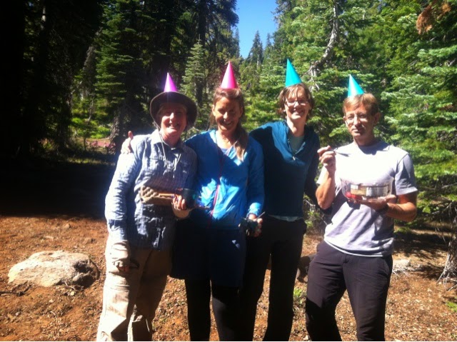
When we went into the Post Office for our resupply boxes Peggy had  surprises waiting there for her, a birthday card from her niece, goodies mailed from her New York Brokerage Firm (how fun is that!) and a box of delicious cookies from Linda, her stepmom.  We both carried cookies in our packs when we exited Old Station the next day.  (The chocolate marshmallow ones were a big hit!)
Robin had his BBQ in the back of his pickup to grill hotdogs and brats,  he had sodas, apples & bananas, cupcakes & cookies.  These were for trail magic when hikers walked in. 
He fixed Peggy & I BLATs (A for avocado) he had bagels, cream cheese avocado & smoked salmon for us for breakfast. There were enough fixings that we were able to eat BLATs for dinner too. 
A guy named Root Beer Float walked in, we'd never met him before.  He said he'd missed trail magic at every stop and this was his first one!
He got 5 grilled dogs, an apple, a banana, 2 cupcakes, a bag of cookies and I gave him some power bars I couldn't fit into my bag. His resupply box hadn't made it in the mail to Chester so he'd come to Old Station on low rations. It was actually pretty fun to see him eat so much and get full.  Two others came in and had the works too.  Later as we were getting our Motel room Alpaca & Yukon arrived and got a room.  Robin gave them fruit and soda as that was about all he had left.   I later shared with Alpaca & Yukon salmon, cream cheese, avocado and fruit that I knew Peggy & I couldn't finish. All the provisions were eaten and enjoyed.  Thank you Robin! 
When we were settled into our rooms Robin drove back to Medford, he'll be in Burney Falls Park in 3 days to meet us there & take me home for a rest. 
The remainder of our day consisted of showers, laundry, resupplying our packs, drying our wet tents and resting. 
We will only take a nero today, we plan on leaving tomorrow after we get an idea of the weather.  We're hoping it remains somewhat overcast because Hat Creek Rim is notoriously hot and has 33 waterless miles.  We'd catch a break if it were cooler and we didn't have to take as much water along.
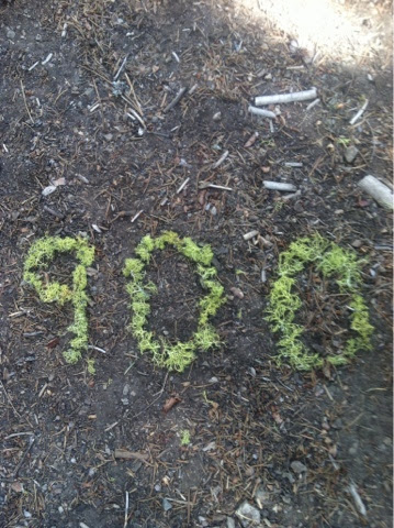
6/27/14 Friday
13.75 miles
Someone's car alarm went off outside our room at 5:30 this morning. Our alarm went off at 7.  We had bagels, avocado, cream cheese & smoked salmon for breakfast, a Dr Pepper and fruit. A few chores and we got out on the trail at 8:30.  It was not overcast but there were puffy clouds in the sky that could offer shade so we each took 4 L of water instead of 5, hoping for cloud cover to help us. 
On the way to Subway Cave 4 miles from Old Ststion.
  When we got there we hid our packs off the trail, took our headlamps, our down jackets for the cold and a L of water. I took my lunch items because they were not in my lock scent bag and an animal might have torn my pack looking for the food. The cave was 1/4 mile down a side trail. There were lots of cars parked at the parking area and we saw GuacRock coming out. He said he'd enjoyed the cave so we headed in. 
Stairway in & out.

Ready to explore.
It got pretty dark in there, our tiny lights were sufficient if we went slow and allowed our eyes to adjust. 
This was in the floor, an area where the gasses bubbled up before things hardened.
We spent about an hour inside, topped off our water at a spigot outside where I scared away a quail getting a drink. We had a snack and went to find the PCT and our packs again. 
Although it's getting warm out I'm glad we did the side trip and saw something new and interesting. This whole area was formed by volcanic activity and is really interesting to poke around in.
We began climbing out of the valley up to the rim which we can see in the distance. 
The trail leads up to a lookout spot that people can drive to.  There's a restroom and information boards along with viewers that allow a closer look at the landscape... But no water. 
We met a gentleman from Talent, Oregon  who gave us each a banana and wanted to talk about our hike. He lives 6 miles from Medford, where I live, we encouraged him to hike more of the trail around there & to try out lightweight equipment. 
We really needed to rest, Peggy's back was hurting and she did some work with her sit pad and duct tape that helped her pack fit better.  We both are losing some weight so our packs fit differently, I've engineered a fix with an extra sock as padding at my waist belt.  I hope Peggy can find a fix that will help her too. 
The wind is blowing quite a bit which helps keep us a little cooler but it is getting warmer. We are climbing up to a long series of lava rock ridges that tower hundreds of feet over the valley. It seems to take forever to get anywhere and we curve back along our trail to get around sharp cuts in the rock. We alternate between walking on lava and walking on dirt with dry grasses and pine needles.  There are smaller trees after the fire that burned here in 2009, started by something like 800 lightening strikes. It was a devastating fire and we can see the effort made by the community to replant trees. Finally we arrive at a dirt road which gives us a bit of flat land to pitch our tents.  We're tired and ready for a rest. Peggy stretches her back and rests without her pack for awhile.  After dinner and getting set up, I am resting without the vestibule of the tent on so the breeze can cool me off.  I think it will be warm enough tonight to sleep without it and see the night sky. 
Peggy took amazing photos of the sunset, black shadows and orange, pink and red colors in the clouds.


6/24/14 Tuesday. Terminal Geyser & Boiling Spring Lake in Lassen Nat'l Park. 6/25/14 Visiting Deer & Rain.

16 miles.
It was after dark that the mosquitos finally quit whining outside the tent.  I woke up and could see brilliant stars covering the sky, it had been warm enough that I'd rolled back the tent fly for ventilation and could lay in bed and see out. 
The trail will take us by the Middle Fork of the Feather River this morning.  On the way down to the river we crossed a dirt road at a curve and angled down the slope.  I could see something along the trail and as I neared, could see it was the passenger seat from a car. Huh, what was that doing there?  It was all chewed up. I looked downhill and saw the cab of a small truck by the side of a tree and to the left there was the bed of the pickup.  I looked uphill to where the road was and there was the hood and broken glass.  Imagination supplied the rest of the awful story. Whoever was driving had gone off the curve of the road and over this steep embankment.  The trail of truck parts was scattered all over above & below the trail. 
At the bottom of the hill was the bridge over the Feather River (it has multiple forks and we've crossed it two times) where we stopped for a snack & wash. 
Feather River
Climbing from the river up the mountains we could sometimes catch views of Mt Lassen getting closer.
Mt Lassen's dome with a small amount of snow. 
In the afternoon we came upon a portion of trail that looked raked. Hmmm, trail maintenance crews had been at work here.  Then we rounded a corner and there they were! 
Raking, clipping brush, edging trail and working hard.  They were out of McCloud, Ca and traveled from Tahoe area to Lassen getting about 12 miles of trail done a year. 
You folks are so appreciated!  
After noon we arrived in Mt Lassen Nat'l Forest, yes, there are signs in the wilderness that tell you when you arrive and leave. This park has geothermal activity; geysers, bubbling mud pots and boiling pools.
One of the things I noticed were big jumbled boulders in the dry creek beds and deep erosion from running water. The forest is full of big trees that lend a certain silence to the surroundings. Peggy went ahead up the hill and when I arrived she was sitting at the trail junction of the PCT and an alternate trail.
We stashed our backpacks to take a side trail .3 miles down to see Terminal Geyser. 
This is as close as I want to get!
It was warm outside anyway but definitely warmer here.
Signs warned to stay off the soil as it could have a thin crust and you could break through.  Peggy & I stand on the rocks.
We climbed the steep trail back to our packs and took a snack break resting our feet and backs which are hurting.
We then took the alternate trail to see Boiling Spring Lake 1.5 miles away.  Oh, it was really something to see (and to smell!). 
The colors were almost surreal!  Creamy green,  grey bubbling mud pots along the lake edges, white dry mud , red soil along the edges. 
My first view of the lake. 
Mud pots bubbled away, you could hear them,  they are in the forefront and among the trees in the center.  It was quite warm by the lake. 
Little butterflies flitted around the edges of the mud pots. Don't know what was attracting them. 
We made our way slowly along the edge.
The red soil is a beautiful contrast. 

We didn't want to leave such an interesting place but we weren't too far from our camp spot near Drakesbad Resort. We were going to a small campground 1/2 mile from the resort. 
Our arrival at the campground allowed us to pick any site we wanted, only one other camper was here. Tents up, feet and legs washed off at the spigot (what an invention! Water out of a pipe whenever you want it!) we also washed some clothes, used the metal bear box for our food and toiletries with odor ie: Deet, toothpaste, lipgloss, all food and wrappers) because there are bears in the area.  Two hikers came in and camped, Summit and Zebra, brother and sister from Ashland, Or, 10 miles from where I live!
We took a moment to celebrate another milestone for our hike, mile 900!

While Peggy was washing up she'd left a plastic bag on the picnic table and the next day discovered a squirrel had eaten a hole in the bag and taken a big bite out of her new peppermint chocolate power bar. Sneaky Squirrel! 
It may be a chilly night with a creek nearby. 

6/25/14 Wednesday
14.5 miles
Behind the campground is a wall of lava and we found our trail switch backing up the wall and over. 
A big cedar tree growing along the ledge of the trail, notice the lava rock wall. 
Can you see the vapor rising from the forest to the left of the big tree?  That's from Boiling Spring Lake. 
We walked through the Park in forest, over streams & by grassy meadows.  We made good time this morning and I felt like my legs had energy as I ate the nuts, cheese and crackers I'd brought from Chester. We came over a hill and entered a large burned area. There was a fire in 2009 that really did damage. Our goal was to reach the Lower Twin Lake for lunch break. We stopped there for water and lunch after soaking our feet.  The wind was blowing and clouds were piling up on the horizon by Mt Lassen peak. 
We were eating lunch sitting by a log when we had 5 curious visitors. 
These Mule Deer stayed for 30 minutes at least, coming within 10 yards of us as our cameras clicked and clicked. 
They ate grasses, licked logs and ate dirt that they burrowed up with their noses. They smelled us and watched us cautiously but stayed to browse. It was magical!
Moving on after they left we came to more burned forest, every tree was black and dead but small grasses had started
in places and some flowers were blooming as if they'd had a shot of fertilizer.  We got carried away taking photos and examining each one.
Pink & white Pussy Paws along the trail were bigger than any we'd seen before. 

Looky looking.  :-)
Flower strewn trail. 
Pussy Paws & Lupine. 
It was getting pretty cloudy and dark, we were hoping the rain would hold off until we could make more miles. 
Mt Lassen surrounded by clouds.
We wanted to get out of the burn so dead trees wouldn't fall on us during the night. But finally we had to just stop when we felt rain start to fall, we put on our pack covers to protect our sleeping bags etc. and located a small copse of live trees that hopefully would protect us. 
Peggy reminded me that I had an avocado I hadn't eaten, it was buried in my food bag & I'd forgotten it.  I opened it, it was perfect!  She had Fritos so she put some in a bag.  
Since we were set up across from each other we tossed our food across the space, she caught her avocado perfectly! I caught the Fritos perfectly.  No getting wet! We savored our treat then had dinner in our tents. It rained softly all night except for brief lulls.  
Tomorrow we will get to Old Station where Robin will meet us for trail magic. 


6/22/14 Sunday. Almost in the Cascades. 6/23/14 Monday. A Quick Stop into Chester.


14 miles.
The alarm buzzed at 5am but I had a headache and both of us agreed another hour of sleep would do us good.
Hiking by 7:15 we had a few far away views of Mt Lassen through the forest.  
Clouds hovering around Mt Lassen, the start of the Cascade Mountain Range. 
We are also beginning to see lava rock mixed in with the soil.  
Definitely volcanic rock.  
It makes the trail rocky and the feet sore!
The trail went over rock strewn buttes.
This route has scattered small springs for water but because of the drought we are unsure whether they are running or not, we feel a bit like we did in the desert.  Should we carry more water and be prepared to find a dry spring?  We think so, but the packs are heavy.
We found a note scratched on someone's  belt lying on the trail.  It said one of the creeks we'd planned on stopping at was dry and we should get water .03 mi down a ravine nearby.  Just then we saw a tall blond guy walking up the ravine.  He said there was a small spring down there with good water.  We decided we should get water where we were sure it was flowing.  We both took 3 L bottles and started down leaving our packs at the top.  It was a steep climb back up but the water was good and we were glad to get some for the miles ahead.
I'm struggling with energy today and had to stop often.  I tried everything, mini snacks, more Gatorade, nothing seems to help and I wonder how I can continue through the next miles. 
We climbed just under this rugged volcanic mountain top that we'd seen in the distance this morning. 

We found a small trailside clearing at 5:45pm just right for two tents.  
As we were eating dinner 2 thru hikers passed us; GuacaRock (from Mexico) & ChinaRock (from China of course). They are hiking big miles and seem strong and happy.  They are some of the front runners and should be able to get to Canada well before the snow flies up there. 
One of the solutions Peggy and I came up with to counter my fatigue is to make a stop in Chester tomorrow.  We'll be crossing  Highway 36 around noon so we'll hitch to Chester for food to supplement both our lunches. The other idea is to get a ride from Burney Falls back to Medford for rest and recuperation. Things to think about.

6/23/14 Monday. 14 miles 
Last night I took a Benedryl to be certain I got a good rest plus set the alarm for 6:00 am for an hour more sleep. We were hiking by 7am but I was on autopilot and not very aware.  We did pass the PCT monument celebrating the 1/2 way point for thru hikers.
Mostly the trail contoured around hillsides, through trees with occasional views of Mt Lassen.
Peggy crossing a meadow on the boardwalk. 
Shortly before we reached Hwy 36 two thru hikers passed us and they looked at us curiously asking if we'd met before. Yes!  We'd met them long before in Big Bear when we shared a ride up to the trail from town,  they were Sherpa & The Boss.
 Peggy & I reached the Hwy before they did only because we went through a gate that they missed and they had to backtrack 1/4 mile.   We had begun hitchhiking to town but  they crossed the road to continue north.  Next thing we knew Sherpa was calling to us that they'd found a cooler of sodas and water. Trail magic!  All of us got a soda,  a nice cool relief in the heat of the day.  Then a pickup truck pulling a boat drove into the wide spot and a man got out.  He wanted to tell us he couldn't pick us up, his truck was too full.  He showed us a book near the cooler with the name of a trail angel who would pick us up at the trail.  He wanted us to call her and not have to hitchhike. What a nice man!
Sherpa & The Boss went north to try to get to Drakesbad Resort,  they wanted to do a 38 mile day...aargh!  So we waved goodbye to them and made a phone call.  Karen answered and would arrive to pick us up in 15 minutes. 
Karen dropped us off at the local burger & milkshake place where we ate a great sandwich & milkshake.  She then directed us to the places we needed to go;  Post Office, Library (Internet, computers &  a book for me to take on the trail), sporting goods store and grocery store. 
Karen works for the local dentist who finished the trail last year and supports PCT hikers by being available to do dental work for any hikers needing it. His office shuttles hikers at 1:30 & 5:30 if they call for rides.  His wife bakes so each hiker gets cookies. They have a photo board where they take your picture and post it in the office.  I love the Welcome PCT Hikers sign!
We shopped at the grocery picking up items that would supplement our lunches,  nut mix, cheese, hearty crackers.  We pushed our carts loaded with our backpacks & poles through the aisles then packed all our new items into our packs.  One last purchase for both of us was a big deli sandwich that we planned on eating for dinner.  When we put the packs on again we groaned,  boy they were heavy!   Crossing  the street making our way to a good hitchhiking spot we passed Alpaca & Yukon who we'd met in Belden & we saw John who had waited for us with Peggy's friends for the birthday party in the woods.  The trail camaraderie is so fun.
It was 5:30pm when we began trying for a ride out of town. After 25 minutes or so a woman pulled over, she was a firefighter just getting home but she also loves hiking the trails around Chester, she didn't mind taking us the 8 miles to the trailhead. 
Wendy, you were so nice to stop for us, be safe in the woods this fire season and enjoy hiking when you're not out there working!
Our plan was to hike to the spring about 4 miles up trail and camp.  The trail led through Collins Pine Company forest. It was full of beautifully spaced pines and firs sprinkled with a few cedar.  Almost a showcase forest.  After 1.5 miles or so it began to look like a normal forest, naturally seeded with the regular debris on the forest floor.  We sat down to eat our sandwiches far enough before our campsite that it wouldn't attract bears.   A young guy named Juicy came hiking behind us and I asked him if he wanted to share my sandwich, I knew I couldn't eat it all before we camped.  He sat right down and ate it!  Peggy & I had our mosquito head nets on, the bugs were all around us.   Juicy chatted a bit while he swatted, ate, said goodbye and disappeared up the trail.   It was only a few more miles to the spring where the mosquitos were still pretty bad.  We hiked beyond it to get more breeze (hopefully), set up tents and went back for water. 
I had called Robin from Chester to make him aware that I will need him to meet us in Burney Falls (5.5 days away) so I could come home for rest.  He said he'd planned to surprise us in Old Station, our next resupply town, with trail magic in 2.5 days anyway!  Oh boy!


6/20/14 Friday. Late Checkout and a Daunting Climb Out of Belden. 6/21/14 Saturday. A Bear & a Birthday Party in the Woods!

7miles
We asked for and got a late checkout so at 2:00 pm we ordered food and sat on the patio of the "lodge" in Belden until we were ready to hike.  We wanted to tackle part of the 14 mile climb out of the Feather River in the cooler part of the day.  Earlier we'd met 2 boys from Tennessee, hiking southbound from Dunsmuir, Ca to Tuolomne Meadows in the Sierras.  They seemed to be hiking on a dime so we secretly bought them breakfast then retired to our room to rest. 
When we came into the lodge in the afternoon they were still there and gave us a big hug as thanks for their meal. They were unable to hike further because of a blister the size of a 50 cent piece on one boys' heel.  Peggy proceeded to sterilize her needle and his foot while I coached him in breathing (pretending it was Lamaze) and she got it drained,  it was quite the procedure!  Neither of us had seen a blister quite that big before. 
We then met an older man named John who was trying to hike out in the afternoon too.  We three decided to start together at 3:30. After goodbyes to the boys from Tennessee we crossed the bridge over the Feather River and the highway and started up the hill, contouring until we could look down on the lodge.  It was still mighty hot outside. The trail was brushy,  poison oak began to appear more often, becoming thicker, hiding in the brush so we had to be really careful not to touch it. We both were hot and sweaty, struggling with all the brush and steep uphill.  John finally went on without us knowing we'd see him at the camp spot in 7 miles or so.  Peggy did see a snake but it was a banded King snake with black, red, black & yellow bands around its body, I only saw a bit of it under a log. Yikes!    We arrived around 7pm at the camp where John was set up, it was near a stream where there were lots of mosquitoes.  After some conversation we all turned in with a promise to wake John when we got up at 5:00am.  No photos of the day, we were too busy breaking through brush or swatting bugs! 

6/21/14  Saturday.  14.5 miles
Deer were tromping around camp last night and I didn't sleep great.  John didn't hear our alarm so it was 5:30 before I could shout to him.  Peggy and I started the last 7.5 miles of steep uphill by ourselves leaving John to finish his packing up.   We had gone about 1 mile when we came to a dry, rocky creek ravine where the trail went steeply down and across the big rocks then back up the other side.  I started down, looking around as I went, and gasped loud enough that Peggy took 2 steps back. Usually that's what I do when I see a snake but this time I said " bear"!
It was a beautiful, blonde colored bear with dark under fur and it was adult sized too. It never smelled us since it was below us in the ravine.  We locked eyes for a split second while Peggy stepped closer to see, it turned and ran down the ravine, fur shimmering as it went.  Peggy saw it's tail end disappearing in the boulders and brush. Our mouths hung opened... what a sight!  It happened too fast for pictures. 
After that we called "Yo bear!" when we walked through the brush.
We did pass our 1/2 way point of 850 miles a while later.  
We crossed creeks and a couple of streams when John finally caught up to and passed us.  Finally we staggered up to what we hoped was the top (it wasn't) and rested.  Moving on after 15 minutes I saw strange people in the brush off the trail.  Were those party hats they had on? 
They yelled "Happy Birthday!"  It was Peggy's 3 friends from San Luis Obispo! Nanine (who has found us 3 times!) Kevin (who has found us 2 times!) and Corinne (who I finally met for the first time!) had driven 11 hrs & hiked 5 miles into the woods where they spent the night hoping to meet us on the trail and surprise Peggy a few days after her birthday.  We were sure surprised!
They'd packed in a chocolate birthday cake with candles and party hats.
Peggy, Nanine, Corinne and Kevin,  party hats and all!
Peggy blowing out candles.
John had come across them in the woods and stayed about 10 minutes hoping we would show up but we had taken that 15 minute break.  We wouldn't see him until 2 days later. 
I should know by now that strange people in the woods are usually Peggy's friends going  'Peggy hunting'!
We all hiked the 5 miles back to their car, ate fruit they had brought, peaches and nectarines,  then they packed up and drove off for home 11 hours away! 
You people are awesome!

The rest of the day was pretty routine, we got water at a nice piped, cold spring,  then hiked to the crest of the mountain and made camp. Both of us were foot weary, tired out, but what a fun way to celebrate Summer Solstice, the longest day of the year. (and the official hike naked day which we happily ignored and no one passed us that celebrated it either, whew!)


Thursday, June 19, 2014

6/17/14 Tuesday. Trees as Far as the Eye Can See. 6/18/14 Wednesday. Section M Ends at Belden. (M means climbing up then down then up & down again)

17 miles
We were up at 5:00 to finish the big climb in the forest, there was no view, only trees, for hours.  Finally we were out  on top of a ridge with a view...but all there was were treed mountains.
Crossing from one forest to another.

 On we hiked in forested quiet until we came to Lookout Rock. 
I'm carefully peeking over the edge.
Miles and miles of forest. 
This is a spring where we got water.

We crossed a road and saw a Ranger truck parked in a pull out by the PCT. I hoped we would run into him because I had questions about tree identification. 
Sure enough, we saw him, a really nice young guy, a hydrologist studying stream reinforcement along the trail. He helped me identify White Fir and another fir I kept getting mixed up with it.  The other was a Red Fir which I'd not heard of before.  He also identified a blueberry oak bush and a chinquapin bush for me. 
Taking a break along the trail, my pack rests beneath fir trees, new growth at the tip of each branch is bright green.  Peggy & I both commented on the brilliant blue of the sky. 
An example of the forest trail, soft needles under foot but no views except trees and more trees. 
I shouldn't complain, after the desert, the shade of trees should be very welcome but it's been chilly all day and when the wind hits our sweaty shirts we get cold fast. 
Late in the afternoon, crossing the paved mountain road going into the town of Quincy,  we had a short break then started to do a few miles of a long climb.  We wanted to break it up a little and camp in a flat spot halfway up that we hoped to find. 
On the way up we passed a historical marker on the side of the trail marking a wagon trail route. 
Peggy has been interested in knowing what existing trails were used to link together parts of the PCT, here's one trail. 
The Beckwourth Trail (a wagon train), it includes a quote from James Woodworth August 17, 1853.  They "found the ascent very difficult",  we concur! 
On the way up the last 2 miles before camp the sky was pretty with these clouds but we wondered if they were bringing the chilly weather. 
Upon reaching a small spring where we'd planned on getting water, Peggy said she wasn't feeling well.  Maybe she needed food & water, maybe being chilly for a few days had taken more energy than she was able to produce on our limited diets. After we both had food, water and rest we moved on, trying for 3 more miles before camping. We made it about 2 miles and we were not able to go further.  We found a flat spot and made camp.  Tents up, food hydrating 100 yards from camp, we ate and turned in.  Neither of us have food for another night out, we have breakfast and lunch for tomorrow so we need to get into Belden tomorrow, 18 miles away. 
 
6/18/14 Wednesday. 18 miles
The alarm went off at 5:00 am but It was really cold so we gave ourselves another hour and got up at 6.  We hiked with jackets on for a bit,  it was cold in the forested shadows.  A few times we came out to clearings of rocky outcroppings that dropped steeply away to small lakes set in granite bedrock. 
You could see the pattern of wind on the lakes even from this high up. 
Lupine along the trail smells sweet.
Bracken fern grows in the shaded forest near a boggy meadow. This was a nice change from dark forest and was just before we crossed over onto dry sandy granite mountain tops covered with low growing brush.  
 This begins our long descent into Belden. 
From an overlook the next valleys are red colored soil and pretty barren. 
As we begin descending this is a look at our back trail just below the trees. Nothing but brush and granite sand. It was 4 miles of switchbacks through this, then scrub oak, then black oak then lots of poison oak as we descended in elevation along the trail.   After 2 hours of switchbacks we popped out beside railroad tracks, crossing those we walked a dirt road right into the Belden Lodge & restaurant.  We got a room, showered, did laundry, rested, got our dry clothes and went to dinner. Some of the thru hikers we'd met in the trail were here having dinner; Homeless Guy, Benco, Alpaca & we met Bones and Reboot, older guys doing the thru hike that started in March. 
Tomorrow 6/19/14 will be a zero day for us, hydrating, building calories etc. we will hike again June 20th for another 6 days, our next destination is Old Station, California, another resupply stop for us. 
Somewhere in the last few days we passed our 800 mile mark and tomorrow we'll cross the 1/2 way mark of our California PCT hike (850 miles)!